Scientists have used the sound of the sea to discover the route taken by hot fluids that feed a supervolcano in southern Italy.
Using an innovative technique that uses the ‘hum’ - or seismic noise - of waves crashing at the coastline of Campi Flegrei, scientists have produced a seismic image of the deeper structure of the volcano that reveals the main route bringing hot fluids to the surface.
Their research has featured in a documentary - ‘The Next Pompeii’ - on Nova, a popular science series on major US broadcaster PBS. The documentary highlights the innovative scientific techniques being used to monitor Campi Flegrei – a volcanic caldera to the west of Naples that last erupted five centuries ago.
The area has been relatively quiet since the 1980s, when the injection of volcanic material in the shallower structure of the volcano caused thousands of small earthquakes, which was followed by 38 years of relative silence.
Seismic imaging is one of the main methods used by scientists to accurately map a volcano’s structure at depth, however the low level of seismic activity in the area over nearly four decades has meant that Campi Flegrei’s inner structure has remained a mystery – until now.
The so-called ‘feeder pathway’ discovered by scientists is believed to have been formed during the last period of seismic activity in the 1980s, and brings volcanic material from the depths of the volcano, located out at sea.
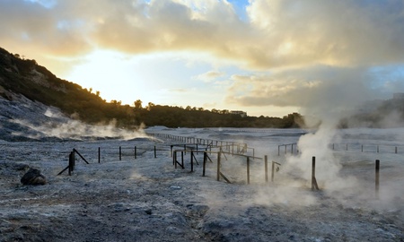
The material then travels up and along established routes beneath the volcano towards fumaroles at Solfatara and Pisciarelli - located approximately in the centre of the caldera - where they are expelled as vapour through steaming vents.
Seismologists Professor Luca De Siena, Dr Carmelo Sammarco and Dr David Cornwell led the study from the School of Geosciences at the University of Aberdeen. They worked alongside the Vesuvius Observatory, which advises the Italian Government’s Department of Civil Protection of the threat posed by volcanic activity in the region.
Professor De Siena, now at the University of Mainz, said: “By using the noise at the seashore to create a seismic image, we have finally a better idea of how volcanic material travels from the depths of the volcano to the surface,”
“This is the first time this relatively new technique has been used in a heavily populated area, and it shows us that the feeder pathway created at the beginning of the 1980s appears fully functional in 2011-2013, when we collected the data.
“This is important as it improves our understanding of the character of the volcano, which may ultimately improve monitoring and early warning procedures in an area inhabited by millions of people.”


