
Interdisciplinary Fellow
- Email Address
- william.harcourt@abdn.ac.uk
- Office Address
- School/Department
- School of Geosciences
Biography
Will Harcourt is an Interdisciplinary Fellow at the University of Aberdeen leading the development of digital twin technology applied to the Arctic cryosphere. He graduated from the University of Exeter with a 1st Class Honours degree in Geography before moving to the University of Edinburgh to study for a MSc in Geographical Information Science (GIS). Between 2017 and 2018, he was a Research Assistant at Edinburgh Napier University, leading the first ever national scale analysis of seagrass change in the world. In 2022, he completed a PhD at the University of St Andrews where he developed millimetre-wave radar as a tool for mapping and monitoring glaciers. He then joined the University of Aberdeen in 2022 as a Lecturer before starting the interdisciplinary research fellowship in 2023.
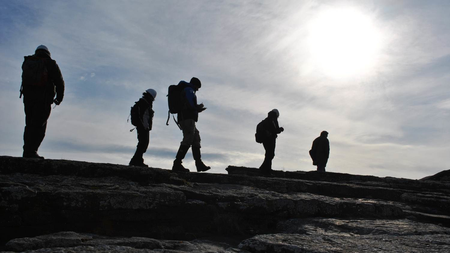
Will's research interests span across multiple disciplines, including glaciology, remote sensing & Earth Observation, data science, artificial intelligence, Arctic science and many more. He works across several international organisations such as the Svalbard Integrated Arctic Earth Observing System (SIOS) and the Scottish Alliance for Geoscience, Environment and Society (SAGES), amongst others before. Through these roles, he builds new community tools, organises webinars & workshops and develops future science strategies/priorities. Will also leaves the office to work in the field and has led and participated in several expeditions to locations such as Svalbard, Iceland, the European Alps, the Scottish Highlands and locally within the UK.
Qualifications
- BSc Geography2016 - University of Exeter
- MSc Geographical Information Science (GIS)2017 - University of Edinburgh
- PhD Physics2022 - University of St Andrews
External Memberships
- International Glaciological Society (IGS)
- European Geosciences Union (EGU)
- Royal Geographical Society (RGS)
- Scottish Alliance for Geoscience, Society and Society (SAGES)
- Association of Polar Early Career Scientists (APECS)
Research Overview
My research is highly interdisciplinary and covers subject areas in geographical sciences, computer sciences, physics and more! My research can be grouped into three main area:
Glaciology
- Glacier Dynamics: Processes influencing ice flow and its changes in a warming climate.
- Ice-Ocean Interactions: The process of iceberg calving and its contribution to mass loss across the Arctic.
- Arctic: I environments across the Arctic, particularly in Greenland and Svalbard, with a focus on glaciers and their interactions with the surrounding environment (terrestrial, marine, atmosphere)
Data Science/AI
- Digital Twins: Developing digital twins for chaotic environment systems such as glaciers (e.g. Svalbard, the Greenland Ice Sheet)
- Machine learning: Application of Artificial Intelligence (e.g. Machine Learning and Deep Learning) to study environmental systems (e.g. glaciers), often using remote sensing data.
- Observing Systems: Construction of inter-connected systems to observe environmental processes and document their changes over time.
- Data Science and Statistics: Development of data processing/analysis techniques for understanding environmental systems, error/uncertainty in environmental data.
Remote Sensing/Earth Observation (EO)
- Remote Sensing: Development of different sensors and techniques for mapping/monitoring environmental systems, particularly glaciers.
- Earth Observation: Harnessing large-scale satellite data for regional/global analysis of the Earth system.
- Database: Cataloguing available data for environmental research, particularly across the cryosphere.
Research Areas
Accepting PhDs
I am currently accepting PhDs in Geography and Environment, Computing Science.
Please get in touch if you would like to discuss your research ideas further.
Geography and Environment
Accepting PhDs
Computing Science
Accepting PhDsResearch Specialisms
- Glaciology and Cryospheric Systems
- Machine Learning
- Remote Sensing
Our research specialisms are based on the Higher Education Classification of Subjects (HECoS) which is HESA open data, published under the Creative Commons Attribution 4.0 International licence.
Supervision
Supervisees
- MR STEVEN WALLACE
- MR JACOB SESTON
Funding and Grants
A full list of successful grants as PI or Co-I from 2019 can be found here: https://williamharcourt.co.uk/grants/
Datasets
03_Ortho_Forefield_Subset.tif:unav- DOI
- 10.18710/b553mb/q1w9t0
- Publisher
- DataverseNO
- Links
- Date Made Available
- 13 May 2025
- Contributors
- Hann, R. (Contributor), Rodes, N. (Creator), Gajek, W. (Creator), Pearce, D. (Creator), Harcourt, W. (Creator), Hann, R. (Contributor), Technology, N. ?. N. U. O. S. A. (Contributor)
Data from: 03_Ortho_20230809_Glacier.tif- DOI
- 10.18710/b553mb/snypu0
- Publisher
- DataverseNO
- Links
- Date Made Available
- 13 May 2025
- Contributors
- Hann, R. (Contributor), Rodes, N. (Creator), Gajek, W. (Creator), Pearce, D. (Creator), Harcourt, W. (Creator), Hann, R. (Contributor), Technology, N. ?. N. U. O. S. A. (Contributor)
03_Ortho_Forefield.tif:unav- DOI
- 10.18710/b553mb/8azv81
- Publisher
- DataverseNO
- Links
- Date Made Available
- 13 May 2025
- Contributors
- Hann, R. (Contributor), Rodes, N. (Creator), Gajek, W. (Creator), Pearce, D. (Creator), Harcourt, W. (Creator), Hann, R. (Contributor), Technology, N. ?. N. U. O. S. A. (Contributor)
Drone-based mapping of calving rates of Borebreen in Svalbard: 02_DEM_20230801_Glacier.tif:unav- DOI
- 10.18710/b553mb/yytqm5
- Publisher
- DataverseNO
- Links
- Date Made Available
- 13 May 2025
- Contributors
- Hann, R. (Contributor), Rodes, N. (Creator), Gajek, W. (Creator), Pearce, D. (Creator), Harcourt, W. (Creator), Hann, R. (Contributor), Technology, N. ?. N. U. O. S. A. (Contributor)
03_Ortho_20230808_Glacier.tif:unav- DOI
- 10.18710/b553mb/og4oh7
- Publisher
- DataverseNO
- Links
- Date Made Available
- 13 May 2025
- Contributors
- Hann, R. (Contributor), Rodes, N. (Creator), Gajek, W. (Creator), Pearce, D. (Creator), Harcourt, W. (Creator), Hann, R. (Contributor), Technology, N. ?. N. U. O. S. A. (Contributor)
03_Ortho_20230811_Glacier_Subset_B.tif:unav- DOI
- 10.18710/b553mb/0spl08
- Publisher
- DataverseNO
- Links
- Date Made Available
- 13 May 2025
- Contributors
- Hann, R. (Contributor), Rodes, N. (Creator), Gajek, W. (Creator), Pearce, D. (Creator), Harcourt, W. (Creator), Hann, R. (Contributor), Technology, N. ?. N. U. O. S. A. (Contributor)
01_Images_20230808.zip:unav- DOI
- 10.18710/b553mb/cfk0x8
- Publisher
- DataverseNO
- Links
- Date Made Available
- 13 May 2025
- Contributors
- Hann, R. (Contributor), Rodes, N. (Creator), Gajek, W. (Creator), Pearce, D. (Creator), Harcourt, W. (Creator), Hann, R. (Contributor), Technology, N. ?. N. U. O. S. A. (Contributor)
03_Ortho_20230812_Glacier.tif:unav- DOI
- 10.18710/b553mb/vgv45b
- Publisher
- DataverseNO
- Links
- Date Made Available
- 13 May 2025
- Contributors
- Hann, R. (Contributor), Rodes, N. (Creator), Gajek, W. (Creator), Pearce, D. (Creator), Harcourt, W. (Creator), Hann, R. (Contributor), Technology, N. ?. N. U. O. S. A. (Contributor)
Drone-based mapping of calving rates of Borebreen in SvalbardThis database contains drone-based mapping data of the crevassed and surging glacier of Borebreen in Svalbard, Norway. The dataset was generated using a structure-from-motion (SfM) method using drone-based imagery. The data was processed with Agisoft Metashape (version 1.8.5) and the processed data consists of digital elevation models (DEMs) in georeferenced .TIF file format, orthomosaic maps in georeferenced .TIF, and textured 3D models in .STL and .PDF file format. In addition, a process report in archived .PDF file format is included for each dataset. Mapping was conducted with a DJI Mavic 2 Pro Enterprise. The fieldwork was conducted in August of 2023 over several days with access to Borebreen via boat. The mapping area covers the crevassed glacier front on five days between 01 Aug 2023 and 12 Aug 2023. In addition, the glacier forefield was mapped over several days and combined into one fileset. There are two subsets of data. First, there are the files Glacier-subset-A/B for the 20230811 dataset. This data contains a subset of the glacier which was taken before (A) anda after (B) a major calving event happening on the same day. It is intended to study very short time-span calving rates. The second dataset is the Forefield-subset, that includes a larger area that was mapped using oblique mapping (in constrast to the nadir mapping in the rest of the dataset. Processing of the data was conducted by Richard Hann. Data aquisiton by Richard Hann and Nil Rodes (20230801). Project and fieldwork support by Wojciech Gajek, Danni Pearce, and William Harcourt.- DOI
- 10.18710/b553mb
- Publisher
- DataverseNO
- Links
- Date Made Available
- 13 May 2025
- Contributors
- Hann, R. (Contributor), Rodes, N. (Creator), Gajek, W. (Creator), Pearce, D. (Creator), Harcourt, W. (Creator), Hann, R. (Contributor), Technology, N. ?. N. U. O. S. A. (Contributor)
Drone-based mapping of calving rates of Borebreen in Svalbard: 02_DEM_Forefield.tif1.0- DOI
- 10.18710/b553mb/bbirof
- Publisher
- DataverseNO
- Links
- Date Made Available
- 13 May 2025
- Contributors
- Hann, R. (Contributor), Rodes, N. (Creator), Gajek, W. (Creator), Pearce, D. (Creator), Harcourt, W. (Creator), Hann, R. (Contributor), Technology, N. ?. N. U. O. S. A. (Contributor)
Drone-based mapping of calving rates of Borebreen in Svalbard: 03_Ortho_20230811_Glacier.tif- DOI
- 10.18710/b553mb/rvo5if
- Publisher
- DataverseNO
- Links
- Date Made Available
- 13 May 2025
- Contributors
- Hann, R. (Contributor), Rodes, N. (Creator), Gajek, W. (Creator), Pearce, D. (Creator), Harcourt, W. (Creator), Hann, R. (Contributor), Technology, N. ?. N. U. O. S. A. (Contributor)
Drone-based mapping of calving rates of Borebreen in Svalbard: 02_DEM_20230808_Glacier.tif- DOI
- 10.18710/b553mb/u4n9sh
- Publisher
- DataverseNO
- Links
- Date Made Available
- 13 May 2025
- Contributors
- Hann, R. (Contributor), Rodes, N. (Creator), Gajek, W. (Creator), Pearce, D. (Creator), Harcourt, W. (Creator), Hann, R. (Contributor), Technology, N. ?. N. U. O. S. A. (Contributor)
Data From Drone-based mapping of calving rates of Borebreen in Svalbard: 02_DEM_20230811_Glacier_Subset_A.tif- DOI
- 10.18710/b553mb/abwhwf
- Publisher
- DataverseNO
- Links
- Date Made Available
- 13 May 2025
- Contributors
- Hann, R. (Contributor), Rodes, N. (Creator), Gajek, W. (Creator), Pearce, D. (Creator), Harcourt, W. (Creator), Hann, R. (Contributor), Technology, N. ?. N. U. O. S. A. (Contributor)
Svalbard Surge Database 2024 (RGI2000-v7.0-G-07)We have developed a new database of surge-type glaciers in Svalbard by combining existing compilations and reviewing studies examining their dynamics. Our database is based upon the Global Land and Ice Measurements from Space (GLIMS) database (König et al. 2014), which is now incorporated into RGI 7.0 (RGI 7.0 Consortium 2023) and consists of 1,583 glaciers in Svalbard. Therefore, the first five fields come from the RGI 7.0 database: rgi_id: Glacier ID from RGI database. glims_id: Glacier ID from GLIMS database. cenlon: Longitude of glacier centre point. cenlat: Latitude of glacier centre point. glac_name: Name of glacier. Our compilation of existing Svalbard-wide glacier surge databases is sourced from several studies: Lefauconnier and Hagen (1991) [LH1991]; Hagen et al. (1993) [H1993]; Sevestre and Benn (2015) [SB2015]; Farnsworth et al. (2016) [F2016]; Kääb et al. (2023) [KA2023]; and Koch et al. (2023) [KO2023]. The compilation of LH1991 only covers eastern Svalbard and is focused on marine-terminating glaciers but is included as it contains several important details on surge characteristics. H1993 is the original database of glaciers across Svalbard and similarly contains details of historical surges. The current RGI 7.0 database defines the “surge status” of each glacier according to Sevestre and Benn (2015): no evidence of surging (0); possible surge (1), probably surge (2), and observed surge (3). Where the SB2015 database does not have corresponding evidence from one of the other compilations, we determine the glaciers surge status to be ‘undefined’ and do not include it in the S_All field. The F2016 compilation was manually translated into the RGI 7.0 database. The glacier names described in F2016 often referred to tributaries which are now combined into single glacier catchments (e.g., Nuddbreen / Strongbreen), hence we manually combined these entries. The recent compilations from KA2023 and KO2023 were manually transcribed from tables in PDF files. The subsequent eight fields document each compilation: SB2015: Surge database from Sevestre and Benn (2015). [0-3] F2016: Surge database from Farnsworth et al. (2016). [0-1] H1993: Surge database from Hagen et al. (1993). [0-1] LH1991: Surge database from Lefauconnier and Hagen (1991). [0-1] KA2023: Surge observations from Kääb et al. (2023). This data set is based on manual surge identification in annual Sentinel-1 interferometric wide-swath (IW) satellite radar backscatter differences between 2017 and 2022 (Kääb et al. 2023). This has been updated in this database (version 3) by mapping more recent surges from winter-to-winter differences 2022-2023, 2023-2024, and 2024-2025 using new IW data. Before 2017, no Sentinel-1 IW data are available over Svalbard, and we use 2015-2016 and 2016-2017 extended wide-swath data (EW) instead, acknowledging that these coarser data (compared to IW) might lead to less detailed surge identification, or overlooking of surges of small glaciers or surges accompanied by only limited backscatter changes. Based on these additional data, we are also able to update some surge information contained in the original KA2023, for instance concerning surge start and end years, and by adding the last year of strongly enhanced backscatter (before backscatter reduction). The new 2015-2025 backscatter-derived surge inventory over Svalbard contains now 40 surging glaciers (the 2017-2022 KA2023 contained 26 surging glaciers). [0-1] KO2023: Surge observations from Koch et al. (2023). [0-1] Other: Surge observations from other literature sources. [0-1] S_Direct: All surges that have been directly observed. [0-1] S_Indirect: All surges that have been indirectly observed e.g. from palaeo-glaciological analysis. [0-1] S_All: All surges that have been either directly observed or inferred from the palaeo-glaciological record. [0-1] Contemporary and palaeo-glaciological evidence of surges is generally limited to the period ~1850–present, which broadly corresponds to the end of the LIA through to the modern-day. Where multiple surges have been recorded, we separate these using “;” in the database, and use “n/a” where the details of the surge have not been recorded. Surges have been classified as a binary 0 (not surge-type) or 1 (surge-type), with the exception of the Sevestre and Benn (2015) database as described above. The subsequent eight fields document (if known) the following characteristics for each glacier in Svalbard: S_Onset: Surge Onset (Year) S_Term: Surge Termination (Year) S_Act_Vel: Max Active-Phase Velocity (m/d) S_Qui_Vel: Mean Quiescence Velocity (m/d) S_Term_Ch: Terminus Change (m) Here, we use 'n/a' for glaciers with no evidence of surging, whilst 'Not observed' is used where we have not observed any of the above characteristics for a glacier with evidence of surging. The final column contains references to where surges have been reported. Included in this version is also a version of the RGI for Svalvard with the new database included.- DOI
- 10.5281/zenodo.15240754
- Publisher
- Zenodo
- Links
- Date Made Available
- 18 April 2025
- Contributors
- Harcourt, W. D. (Creator), Pearce, D. (Creator), Gajek, W. (Creator), Lovell, H. (Creator), Mannerfelt, E. S. (Creator), Kääb, A. (Creator), Benn, D. (Creator), Luckman, A. (Creator), Hann, R. (Creator), Kohler, J. (Creator)
-
03_Ortho_Forefield_Subset.tif
:unav- DOI
- 10.18710/b553mb/q1w9t0
- Publisher
- DataverseNO
-
Data from: 03_Ortho_20230809_Glacier.tif
- DOI
- 10.18710/b553mb/snypu0
- Publisher
- DataverseNO
-
03_Ortho_Forefield.tif
:unav- DOI
- 10.18710/b553mb/8azv81
- Publisher
- DataverseNO
-
Drone-based mapping of calving rates of Borebreen in Svalbard: 02_DEM_20230801_Glacier.tif
:unav- DOI
- 10.18710/b553mb/yytqm5
- Publisher
- DataverseNO
-
03_Ortho_20230808_Glacier.tif
:unav- DOI
- 10.18710/b553mb/og4oh7
- Publisher
- DataverseNO
-
03_Ortho_20230811_Glacier_Subset_B.tif
:unav- DOI
- 10.18710/b553mb/0spl08
- Publisher
- DataverseNO
-
01_Images_20230808.zip
:unav- DOI
- 10.18710/b553mb/cfk0x8
- Publisher
- DataverseNO
-
03_Ortho_20230812_Glacier.tif
:unav- DOI
- 10.18710/b553mb/vgv45b
- Publisher
- DataverseNO
-
Drone-based mapping of calving rates of Borebreen in Svalbard
This database contains drone-based mapping data of the crevassed and surging glacier of Borebreen in Svalbard, Norway. The dataset was generated using a structure-from-motion (SfM) method using drone-based imagery. The data was processed with Agisoft...- DOI
- 10.18710/b553mb
- Publisher
- DataverseNO
-
Drone-based mapping of calving rates of Borebreen in Svalbard: 02_DEM_Forefield.tif
1.0- DOI
- 10.18710/b553mb/bbirof
- Publisher
- DataverseNO
-
Drone-based mapping of calving rates of Borebreen in Svalbard: 03_Ortho_20230811_Glacier.tif
- DOI
- 10.18710/b553mb/rvo5if
- Publisher
- DataverseNO
-
Drone-based mapping of calving rates of Borebreen in Svalbard: 02_DEM_20230808_Glacier.tif
- DOI
- 10.18710/b553mb/u4n9sh
- Publisher
- DataverseNO
-
Data From Drone-based mapping of calving rates of Borebreen in Svalbard: 02_DEM_20230811_Glacier_Subset_A.tif
- DOI
- 10.18710/b553mb/abwhwf
- Publisher
- DataverseNO
-
Svalbard Surge Database 2024 (RGI2000-v7.0-G-07)
We have developed a new database of surge-type glaciers in Svalbard by combining existing compilations and reviewing studies examining their dynamics. Our database is based upon the Global Land and Ice Measurements from Space (GLIMS) database (König ...- DOI
- 10.5281/zenodo.15240754
- Publisher
- Zenodo
Courses
Page 1 of 1 Results 1 to 20 of 20
Utilizing Seismic Station Internal GPS for Tracking Surging Glacier Sliding Velocity
Gajek, W., Luckman, A., Harcourt, W., Pearce, D., Hann, R.Journal of Glaciology, vol. 71, e40Contributions to Journals: ArticlesExploring Segment Anything Foundation Models for Out of Domain Crevasse Drone Image Segmentation
Wallace, S., Durrant, A., Harcourt, W., Hann, R., Leontidis, G.Chapters in Books, Reports and Conference Proceedings: Conference ProceedingsSpatial and temporal variations in 94 GHz radar backscatter from a springtime snowpack
Harcourt, W. D., Robertson, D. A., Macfarlane, D. G., Rea, B., James, M., Diggins, M., Fyffe, B.IEEE Journal of Selected Topics in Applied Earth Observation and Remote Sensing, vol. 18, pp. 3611-3624Contributions to Journals: ArticlesStructural weaknesses in ice mélange revealed by high resolution ICEYE SAR imagery
Harcourt, W., Shahin, M., Stearns, L., Shankar, S.Working Papers: Preprint Papers- [ONLINE] DOI: https://doi.org/10.31223/X5X138
Automated Crevasse Mapping Using Deep Learning Foundation Models to Analyse Climate Change and Glaciology
Wallace, S., Durrant, A., Harcourt, W. D., Leontidis, G.Contributions to Conferences: Oral Presentations- [ONLINE] DOI: https://doi.org/10.5194/egusphere-egu24-12922
- [OPEN ACCESS] http://aura.abdn.ac.uk/bitstream/2164/23353/1/EGU24-12922-print.pdf
Surge initiation at the terminus of Borebreen (Svalbard): Drivers and impact on calving
Harcourt, W. D., Gajek, W., Pearce, D., Hann, R., Luckman, A., Rea, B. R., Benn, D. I., James, M. R., Spagnolo, M., Nanni, U.Contributions to Conferences: Oral Presentations- [ONLINE] DOI: https://doi.org/10.5194/egusphere-egu24-1505
3D terrain mapping and filtering from coarse resolution data cubes extracted from real-aperture 94 GHz radar
Harcourt, W., Macfarlane, D. G., Robertson, D.IEEE Transactions on Geoscience and Remote Sensing, vol. 62, 5102218Contributions to Journals: Articles94 GHz Radar Backscatter Characteristics of Alpine Glacier Ice
Harcourt, W. D., Robertson, D. A., Macfarlane, D. G., Rea, B. R., Spagnolo, M.Geophysical Research Letters, vol. 50, no. 21, e2023GL104721Contributions to Journals: ArticlesHansbreen’s calving-driven ice loss derived from seismic data supported by millimetre-wave radar scans and neural networks
Gajek, W., Harcourt, W., Pearce, D.EGU General Assembly 2022, pp. EGU22-4179Contributions to Conferences: AbstractsWhere to fish in the forest?: Tree characteristics and contiguous seagrass features predict mangrove forest quality for fishes and crustaceans
Wanjiru, C., Nagelkerken, I., Rueckert, S., Harcourt, W., Huxham, M.Journal of Applied Ecology, vol. 60, no. 7, pp. 1340-1351Contributions to Journals: ArticlesGlacier monitoring using real-aperture 94 GHz radar
Harcourt, W. D., Robertson, D. A., Macfarlane, D. G., Rea, B., Spagnolo, M., Benn, D. I., James, M. R.Annals of Glaciology, vol. 63, no. 87-89, pp. 116-120Contributions to Journals: ArticlesAssessment of ice mélange impacts on tidewater glacier dynamics using high resolution ICEYE imagery
Harcourt, W. D., Stearns, L. A., Shahin, M. G., Shankar, S.Contributions to Conferences: Oral PresentationsMillimetre-wave radar observations of glacier calving at Hansbreen (Svalbard) correlated with TLS, time-lapse camera images and seismic records
Harcourt, W. D., Robertson, D. A., Macfarlane, D. G., Rea, B. R., Spagnolo, M., Benn, D. I., James, M. R., Gajek, W., Pearce, D., How, P.Contributions to Conferences: Oral PresentationsSIOS’s Earth observation and remote sensing activities toward building an efficient regional observing system in Svalbard
Fjæraa, A. M., Jawak, S. D., Harcourt, W., Aparício, S., Pohjola, V., Andersen, B., Hübner, C., Jennings, I., Matero, I., Godøy, ?., Lihavainen, H.Contributions to Conferences: Oral PresentationsObserving iceberg size distributions and implications for calving processes
Shiggins, C., Lea, J., Harcourt, W., Shankar, S., Brough, S., Fahrner, D.EGU General Assembly 2022, pp. EGU22-9298Contributions to Conferences: Abstracts94 GHz radar mapping of terrestrial snow cover
Harcourt, W. D., Robertson, D., Macfarlane, D., Rea, B., James, M., Fyffe, B., Diggins, M.vEGU21, pp. EGU21-2747Contributions to Conferences: AbstractsANALYSIS OF FILTERING TECHNIQUES FOR INVESTIGATING LANDSLIDE-INDUCED TOPOGRAPHIC CHANGES IN THE OETZ VALLEY (TYROL, AUSTRIA)
Gutierrez, I., Gjermundsen, E. F., Harcourt, W. D., Kuschnerus, M., Tonion, F., Zieher, T.ISPRS Annals of the Photogrammetry, Remote Sensing and Spatial Information Sciences, vol. 2, pp. 719-726Contributions to Journals: ArticlesObserving the cryosphere with millimetre wave radar: The case study of Rhône Glacier
Harcourt, W. D., Macfarlane, D. G., Robertson, D. A., Rea, B., Spagnolo, M.Chapters in Books, Reports and Conference Proceedings: Conference Proceedings- [ONLINE] DOI: https://doi.org/10.5194/egusphere-egu2020-595
Subglacial controls on dynamic thinning at Trinity-Wykeham Glacier, Prince of Wales Ice Field, Canadian Arctic
Harcourt, W. D., Palmer, S. J., Mansell, D. T., Brocq, A. L., Bartlett, O., Gourmelen, N., Tepes, P., Dowdeswell, J. A., Blankenship, D. D., Young, D. A.International Journal of Remote Sensing, vol. 41, no. 3, pp. 1191-1213Contributions to Journals: Articles- [ONLINE] DOI: https://doi.org/10.1080/01431161.2019.1658238
The thin(ning) green line? Investigating changes in Kenya seagrass coverage
Harcourt, W., Briers, R., Huxham, M.Biology Letters, vol. 14, 20180227Contributions to Journals: Articles