What's next?

- Linking the erosion at the scour-pits to deposition on the floodplain
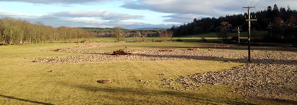
We've also surveyed the sediment that was deposited across the floodplain downstream of the bridge. And a good job too as the repair and recovery work carried out by the Council and Dunecht Estate has now cleared much of this part of the story. So - with your help - we can reconstruct what happened during the flood at Aboyne Bridge - and we'll be able to help improve the resilience of the bridge, and other such structures to future flood events.
- If we are able to reconstruct the floodwater levels at Aboyne Bridge using this technique then we can turn our attention to other locations along the Dee valley - and elsewhere of course.
If crowd-sourced photographs can be used to track water levels during floods then there is the possibility of using these records instantly to chart developing water-levels along the river for future flood events. Such real-time high-resolution information could allow for more strategic responses to flood events as they happen….
