Location
Entrance to the old harbour
Portsoy, Banffshire
OS Map Reference
NJ 589 663
Description
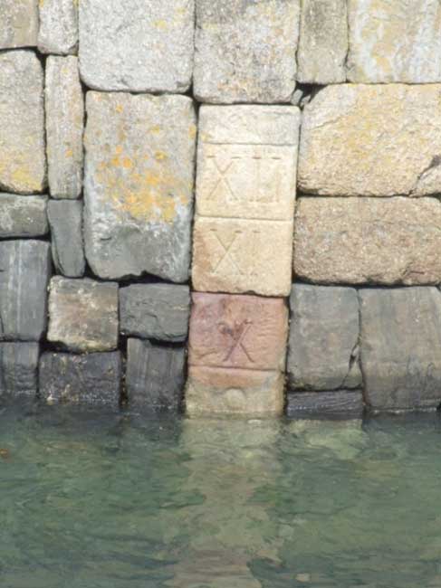
Numerals carved in nicely dressed blocks to indicate depth, they appear to change from Arabic to Roman between 9 and X, presumably to maximise clarity. See the external link to RCAHMS for aerial views etc.
Related Information
Portsoy has two harbours, basically the old one and the new, the old harbour dates from 1697. Portsoy was one of the many harbours on the Banffshire coast which was bustling with activity generated by the herring fishing, drifters were the most popular boats mostly Skaffies and Zulus and at its peak the fleet totalled 57 boats. With the introduction of bigger boats and steam around the beginning of the 20th century the majority of the Portsoy fishing fleet had to move to the larger harbours of Macduff and Buckie.
Portsoy is marked on Blaeu's Map, but the first harbour seems to have been built by Sir Patrick Ogilvie of Boyne, perhaps not long before 1701, in which year customs duties on marble from his quarries were remitted for nineteen years in recognition of the expenses that he had incurred; in 1724 the place was credited with 'a safe harbour and Bullwork'.
The new harbour was built by the Earl of Seafield between 1825 and 1828, but the pier enclosing it was demolished by storms in 1839 and in 1842 (the date at which the last of these events was recorded) only the old harbour was in use. At that time some eight to ten vessels were owned in the place, and a similar number of foreign ones (mainly from the Baltic) traded there; exports consisted mainly of grain and herrings. In 1847 Portsoy was classed as a 'small pier harbour', having an inner and an outer basin.
Most of the existing structure probably represents rebuilding carried out in 1884, but the variety of the types of masonry - eg: rough blocks, small squared blocks and courses of stones set vertically, this last paralleled at Burghead - points to work of more than a single period. A bollard on the central jetty, formed from a large undressed block, has an air of considerable antiquity while some of the old warehouses that front on the harbour probably date from an early stage in its development.
During January 1839 the harbour was damaged twice due to storms and gale force winds (January 7th and 30th). Due to the storms extensive rebuilding work had to be carried out. Since then the harbour has stood the blast from the Arctic winds and Moray Firth waves exceptionally well. Recently the high breakwater has been strengthened.
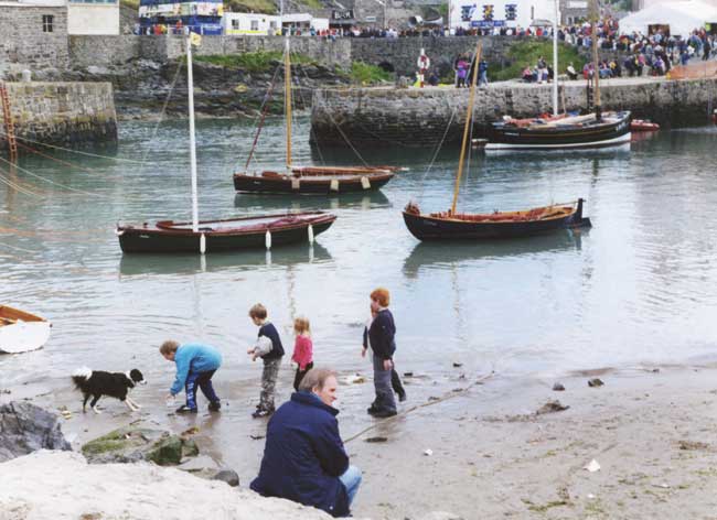
The harbours were acquired by the Portsoy Town Council (now superseded by the Aberdeenshire Council) in 1932. Today, the harbours at Portsoy are used by small pleasure craft and inshore fishermen with their creel boats which they use to catch lobster and crab. The harbours were once packed with herring drifters and Portsoy had its own salt works now they are also home to the annual 'Scottish Traditional Boat Festival' which is getting bigger every year.
Portsoy marble (actually a green serpentine) was used in the fireplaces of King Louis XIV's Palace of Versailles in France and in the Hermitage St. Petersburgh.
Era
1600s
Information Source
S.Bruce and RCAHMS.
Categories
External Links
Photographer
- Stanley Bruce
Unavailable Data
- Date
- Related Artefacts
- Iconography
- Creator
This content was submitted by external contributors and does not necessarily reflect the views of the University of Aberdeen.


