Location
On the slopes of Bennachie, near Monymusk
Inverurie, Aberdeenshire
OS Map Reference
NJ 691 205
Description
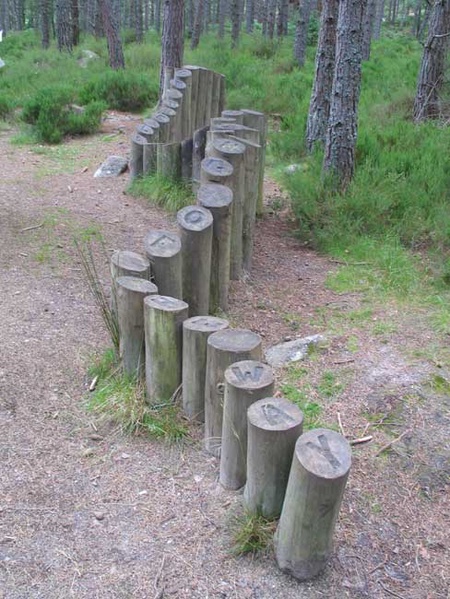
OS ref is approximate. A serpentine arrangement of lengths of round timber set upright in the ground. Each post is branded with a letter on the top so that the whole piece spells out the aphorism "The folding of the land is the unfolding of the way"
Related Information
One of several contemporary sculptures on the slopes of Bennachie.
Bennachie is a small mountain, its most prominent peak "the Mither Tap" has an Iron Age fort on its summit. It has been suggested as a possible location of the battle of Mons Graupius (a battle between the Romans and the Caledonians, described by Tacitus) without there being any tangible evidence for this although archaeological finds do show it to have been an important site at least from the neolithic period onward.
Era
2000s
Related Artefacts
- Bennachie Story Wall Hanging
- Bennachie typewriter sculpture
- Bennachie, Totem Pole
- Dr Danny Gordon's cairn and a memorial bench
- Old Road, Bennachie Centre
- THE CALLING OF THE CUCKOO IS THE OTHER SIDE OF SPRING
- The Felling of the Timber, is the making of the home
- the Gouk Stone, Bennachie
Categories
Creator
- Jonathan Claxton, Artist
Photographer
- David Watson Hood
Unavailable Data
- Date
- Information Source
- Iconography
- External Links
This content was submitted by external contributors and does not necessarily reflect the views of the University of Aberdeen.

